3D laser scanning services in Brisbane & SEQ
Millions of measured points and 360° photos of your site, captured in one visit.
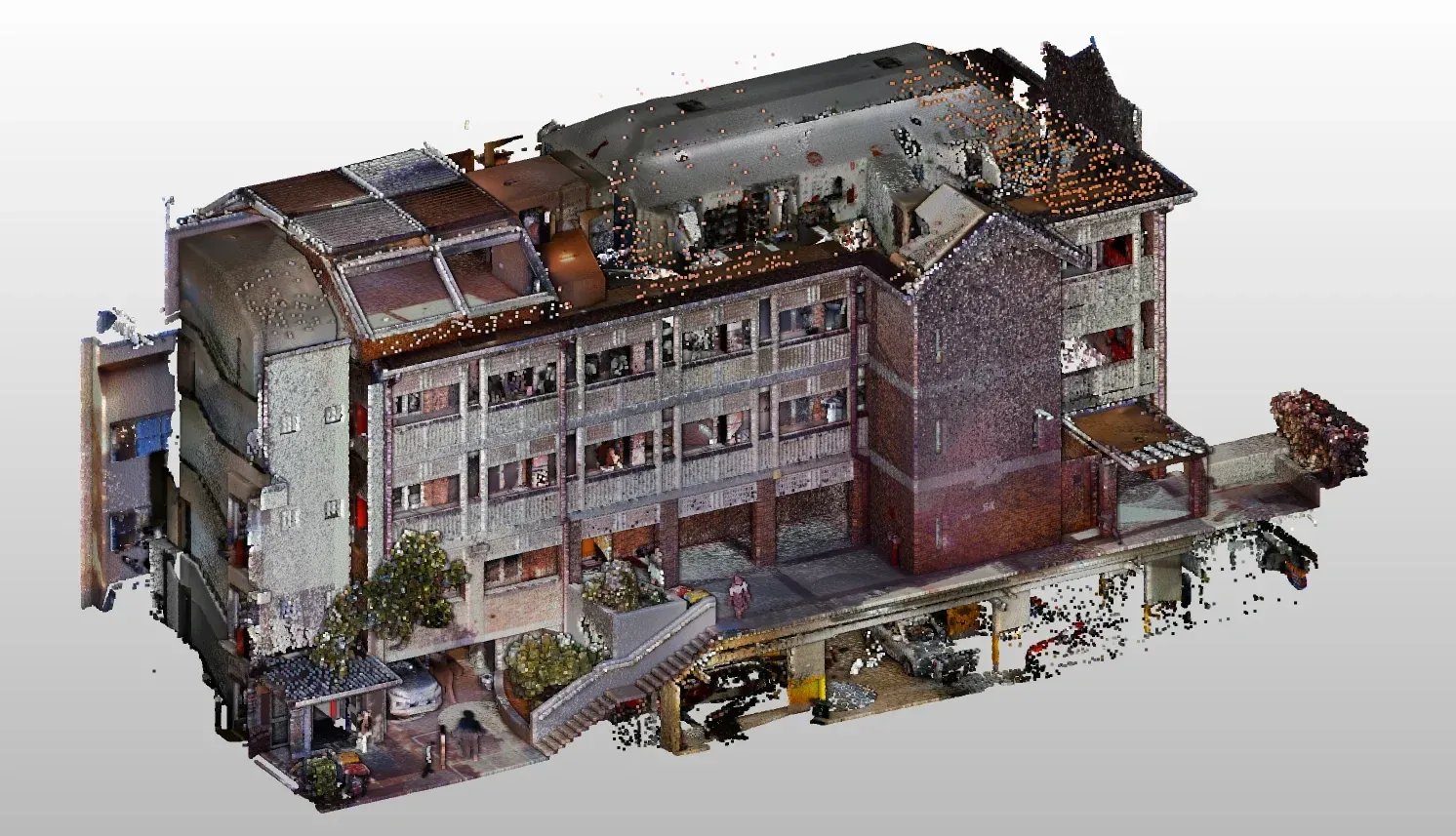
Our terrestrial laser scanner (LiDAR) captures every visible surface and feature of your building or site to millimetre-level accuracy. The result is a point cloud: a digital twin made of millions of measured points. Open it in a free viewer or link it into your modelling software as a reference for design or analysis. Need a model? Our scan to BIM service turns the point cloud into a BIM model of your building or site, in Revit or IFC.
Every scan also captures high-resolution 360° photos, which we turn into a measurable 360° walkthrough. No installs, no licences: open the file and take measurements straight from the photos. Fewer site visits, more time for planning and design.
- Accuracy
- Visible surfaces and features measured with high accuracy and detail
- Scan resolution
- Millions of points measured in a single scan
- 360 imagery
- High resolution images, where you can take measurements
- Point cloud
- View it in a 3D viewer or attach to modelling software as reference
Same scanner, four kinds of survey.
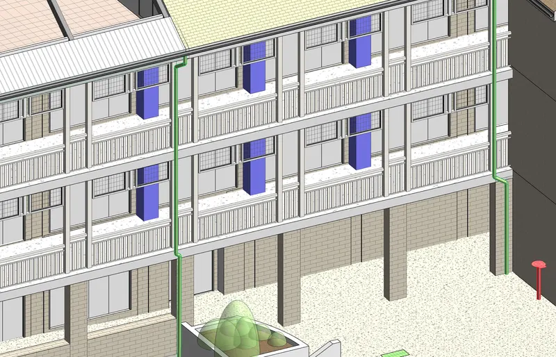
We provide accurate measurements of existing buildings using 3D laser scanning and create BIM survey models for complex renovations, extensions or redevelopments.
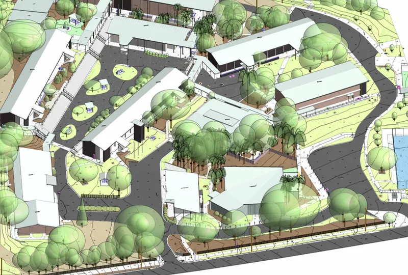
Precise measurement of existing site features and levels, topography, structures and services for a seamless project design.
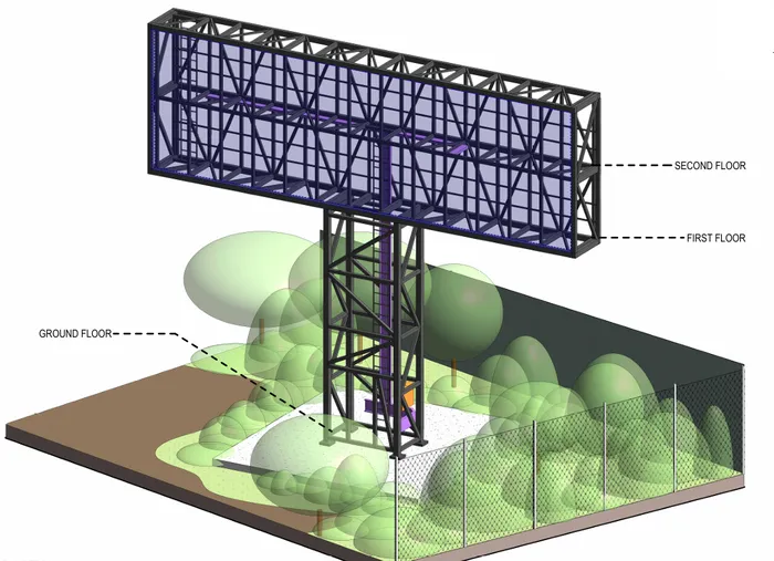
As-built 3D models and dimensioned drawings of steelwork, equipment, machinery and vessels.
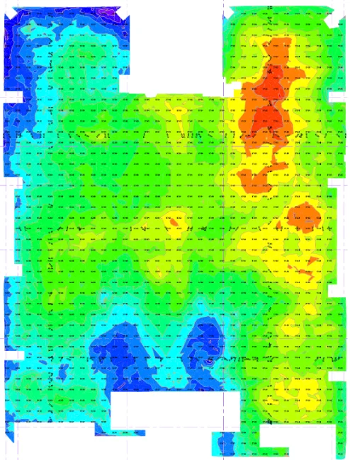
We measure floors, slabs, walls and structures to show flatness, plumbness, movement over time or compare it to the design. You get colour-coded deviation maps and clear reports, all for one fixed fee.
From site to point cloud in three steps.
- 01
Scanning
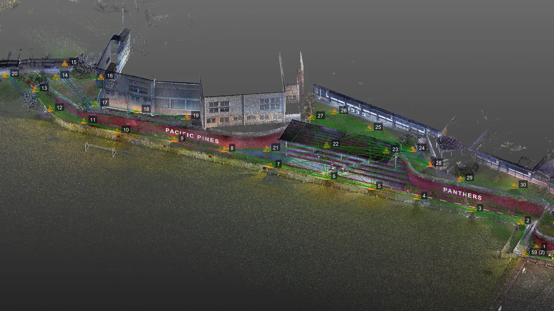
We set up the laser scanner across the site. Each setup measures millions of points in a couple of minutes, capturing the position and colour of everything in range. Multiple setups give full coverage.
- 02
Registration
Every individual scan is joined together into one point cloud of the whole site.
- 03
Delivery
You get a measurable 360° walkthrough and the point cloud in your chosen file format.
Measure the site from your desk.
Need one more level or dimension? Take it from the photos instead of going back to site.
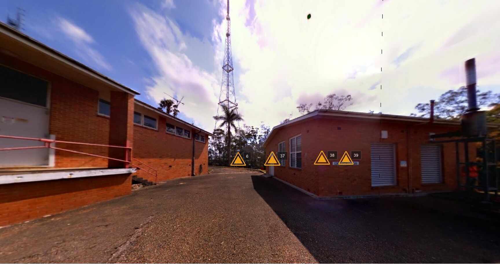
Delivered as one folder. Open the .exe on any Windows PC and start exploring.
A tape measure gets you dimensions. A scan gets you a digital twin.
Fewer surprises
Designs start from what's actually there, not old drawings, so clashes show up on screen, not on site.
Fewer site visits
Forgot a dimension? It's probably in the scan. Many follow-up questions get answered from the data, and your team can check dimensions remotely.
Capture more
Ceilings, roofs and steelwork at height are captured in the scan.
3D laser scanning FAQ.
About 3D laser scanning
3D laser scanning is a non-contact technology that uses lasers to capture the exact physical shape and dimensions of a site or structure. The scanner projects millions of laser points per second to create a highly accurate digital replica made of point data—known as a point cloud.
Compared to manual or traditional methods, 3D laser scanning is significantly faster, safer, and more comprehensive. It captures millions of measurement points in minutes, reduces missed measurements and return site visits, and records complex or hard-to-reach features in detail. Your design team can also check dimensions remotely in the point cloud and walkthrough.
3D scanning is ideal for complex commercial or industrial redevelopments or upgrades, heritage site preservation, structural engineering, civil infrastructure, MEP/HVAC modeling and projects where precise spatial accuracy is essential.
Deliverables & Data Integration
Depending on your project requirements, we deliver processed Point Cloud files (.e57, .rcp, .las, .pts).
Every survey we do includes a free 360° walkthrough where you can take measurements (No install .exe file for Windows).
We can also use scans to produce 2D CAD drawings (.dwg, .dxf), or complete 3D BIM models (.rvt for Revit, .ifc for ArchiCAD and others).
Yes. Our deliverables are fully compatible with industry-standard software like Autodesk Revit, AutoCAD, ArchiCAD, and Civil 3D. Architects and engineers can seamlessly import the point cloud data as an accurate 3D backdrop for immediate design work. Our expert team can help you integrate point clouds into your workflows.
Accuracy & Logistics
We measure visible surfaces and features with high accuracy and detail. Achievable accuracy depends on the surfaces being measured, site conditions and survey control. For models, your quote states the modelling tolerance: typically ±30 mm (Low), ±10 mm (Standard) or ±5 mm (High), measured as the average deviation between the model and the point cloud.
A standard resolution single scan takes ~3‑4 minutes per scan and can capture everything within its line of sight up to an effective range of 10‑20m, depending on site conditions and obstructions. We take multiple scans to cover all areas within our scope of work. Your quote will specify expected 3D scanning survey duration.
Scanning time depends on the type of survey:
- 3D scanning time of an internal building depends on number of rooms, access restrictions and complexity of the layout. We usually need 2‑4 scans per typical room, complex layouts may require more scans to ensure full coverage. If in-ceiling service scans are required, additional 4‑6 scans may be required per room, depending on configuration of services.
- 3D scanning time of an external site depends on complexity, visibility and accessibility. On a typical project we take a scan every 10‑20m. This ensures high coverage of site features and provides multiple scan stations for the 360 degree walkthrough.
Yes. Because 3D laser scanning is completely remote and non-intrusive, we can measure occupied buildings, open public spaces, active construction sites, or high-traffic areas without disrupting daily operations or endangering site personnel. We've done live hospitals, schools and universities, water treatment plants, factories and many commercial properties.
Cost & Project Planning
Pricing depends on several factors: the overall size and spatial complexity of the site, site accessibility, scan resolution that is required, and whether you need just point cloud and the walkthrough or if you want us to prepare 2D CAD floorplans, or full 3D BIM models in Revit or IFC.
To ensure the highest accuracy and speed, minimize line-of-sight obstacles where possible and ensure safe, efficient access to key areas. If we're scanning an external site, please mow the grass and remove excessive vegetation. In short, the more the scanner can see, the better the result will be.
Provide site inductions and access approvals ahead of time.
Send us your project brief.
Tell us about the project, the address, the area to survey and what your team needs. Attach your RFQ or a marked-up plan.
Based in Brisbane, working across Brisbane, the Sunshine Coast and Gold Coast.